N33° 51' E 130° 47’
Research and installation project, CCA - Center for Contemporary Art, Kitakyushu, Japan, january 2002.
How to draw a map of Kitakyushu
from scratch and which could be the tools and strategies to use? These two questions
define the project aimed at drawing the map of an unknown territory, in that
case Kitakyushu, trying to replicate the attitudes and techniques of ancient
explorers.
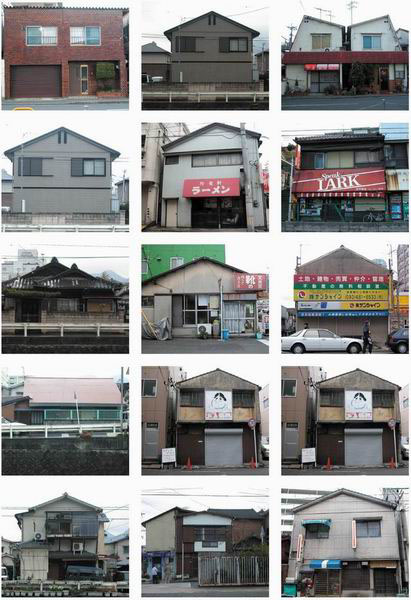
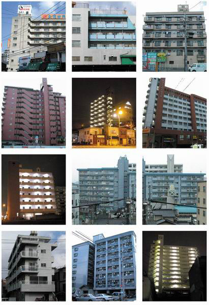
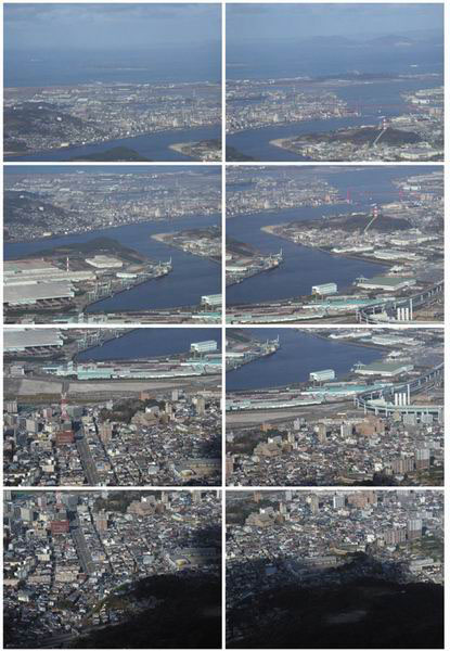
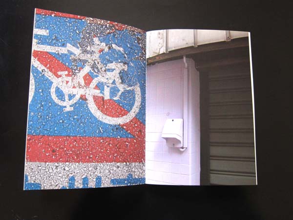
Starting from that artificial condition of absence of information, getting lost
and needing to find a way to orient movements across the city, perceived as
a terra incognita, allow to render manifest predefined ideas, attitudes, tendencies,
ways of seeing which are proper to the observer.
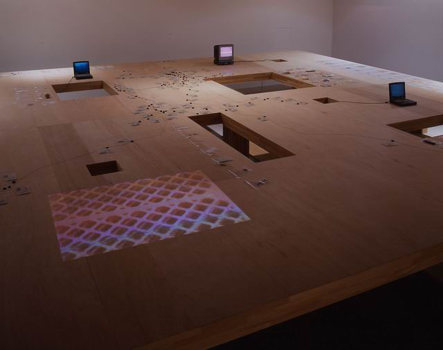
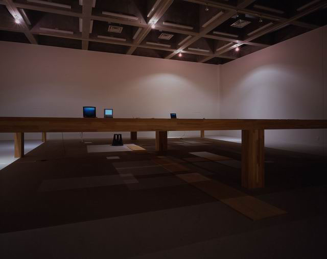
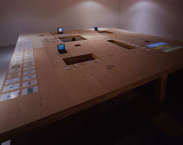
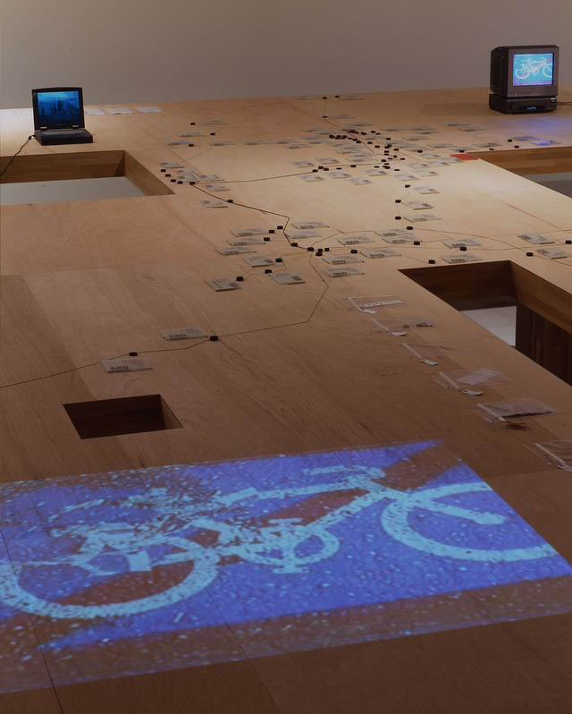
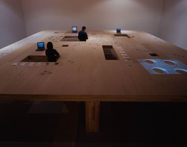
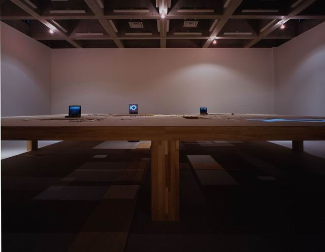
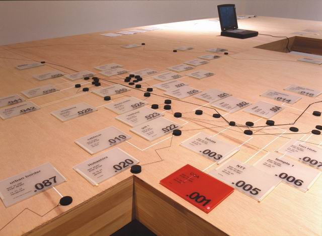
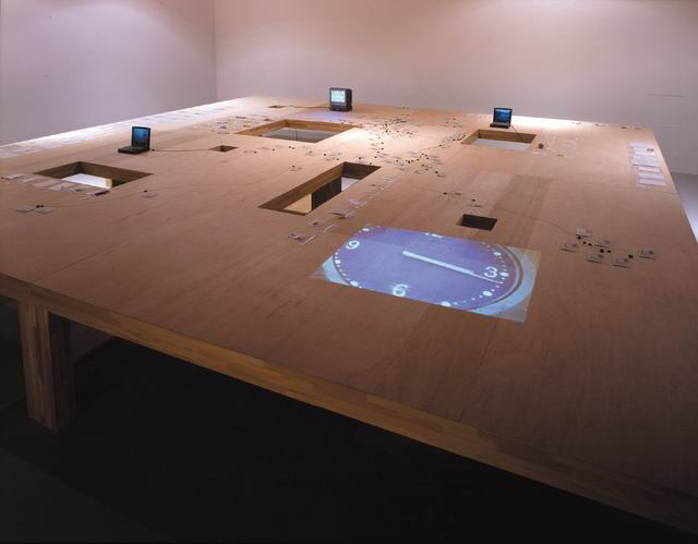
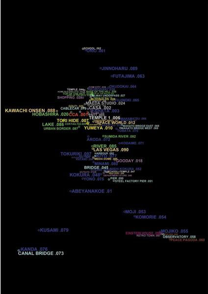
The first operation consists in the creation of an unnatural condition: to avoid
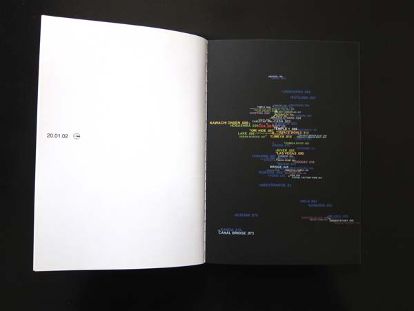
using already existing maps of the city. A GPS device (Global Positioning System)
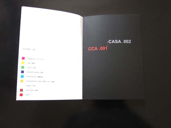
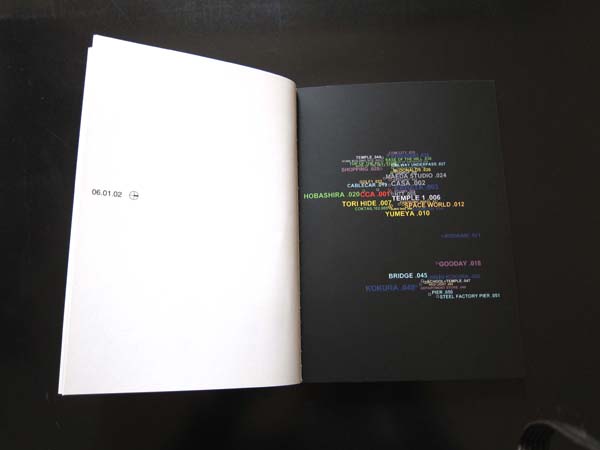
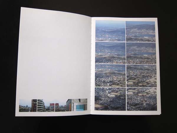
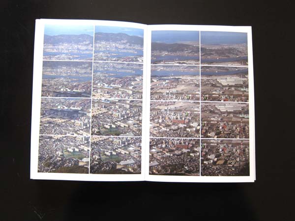
has been used to register itineraries, tracks and relevant spots of several
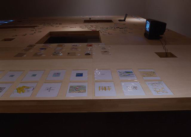
explorations realized during two months. Data from the GPS have then been inserted
into a CAD drawing to obtain a representation of several drifts through the
territory of Kitakyushu, almost as a palimpsest where to insert notes, sketches,
objects found during the wandering, snapshots and filming. The use of an extremely
accurate electronic device is developed in analogy with the tradition of the
geographical explorations of the XIX century, when the use of scientific instruments
allowed defining a structure for the registration of a subjective experience.
The map rather than becoming the objective representation of a given territory,
it is transformed into a travel diary, that reveals the processes of discovery
and loss.
N 33°51.917', E 130°47.808' are latitude and longitude of the Center
for Contemporary Art in Kitakyushu, Japan.
Come si può disegnare
una mappa di Kitakyushu da zero e quali potrebbero essere gli strumenti e le
strategie da usare? Intorno a queste due domande ruota il progetto che mira
a disegnare la mappa di un territorio sconosciuto, in questo caso Kitakyushu,
cercando di imitare l'attitudine e le operazioni degli esploratori e dei geografi
del passato.
Il partire da una condizione artificiale di mancanza di informazioni, perdendosi
e avendo bisogno di definire un modello per orientare il movimento attraverso
la città, percepita come "terra incognita", permette di rendere
evidente idee predefinite, attitudini, tendenze, modi di guardare che sono propri
dell'osservatore.
La prima operazione consiste nella creazione di una condizione innaturale: evitare
l'utilizzo di mappe della città già esistenti. Un dispositivo
GPS (Global Position System), è stato usato per registrare gli itinerari,
le tracce e i punti significativi delle esplorazioni realizzate nel corso di
due mesi. I dati ricavati dal GPS sono stati poi inseriti in un disegno CAD
al fine di ottenere una rappresentazione delle differenti derive attraverso
il territorio di Kitakyushu, quasi come uno palinsesto dove inserire note, schizzi,
oggetti trovati durante il vagabondare, insieme a fotografie e brevi filmati.
L'uso di un sistema elettronico estremamente accurato, si sviluppa in analogia
con la tradizione delle esplorazioni geografiche del XIX secolo, quando l'uso
di strumenti scientifici permetteva di definire una struttura di riferimento
per la registrazione di un'esperienza soggettiva. La mappa piuttosto che configurarsi
come la rappresentazione oggettiva di un territorio dato, diviene un diario
di viaggio che disvela il processo di scoperta e di smarrimento.
N 33°51.917', E 130°47.808' sono la latitudine e la longitudine del
Center for Contemporary Art a Kitakyushu in Giappone.
with Francisca Insulza
Published in: gruppo A12,
Francisca Insulza, N 33° 51' E 130° 47’, CCA, Kitakyushu 2002